GTA 6 locations
The regions and places of Leonida confirmed so far, from Vice City to the Leonida Keys, with what each one is known for and how we know it.
Region
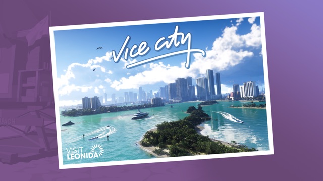
Vice City
Leonida's big city and the heart of GTA 6: glamorous, greedy and loud, from the art deco hotels of Ocean Beach to the bakeries of Little Cuba.
Region
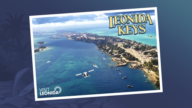
Leonida Keys
A laid-back tropical island chain where life is easy but the surrounding waters are dangerous, and home turf for Jason Duval and Brian Heder.
Region
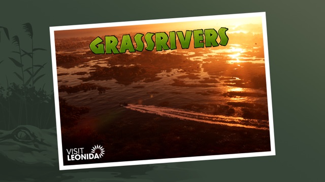
Grassrivers
Leonida's wild wetlands: gators, deadlier predators and strange discoveries hidden in the mangroves.
Region
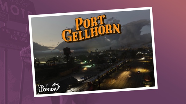
Port Gellhorn
A faded vacation town of cheap motels and closed-down attractions, where a newer and seedier economy has taken over.
Region
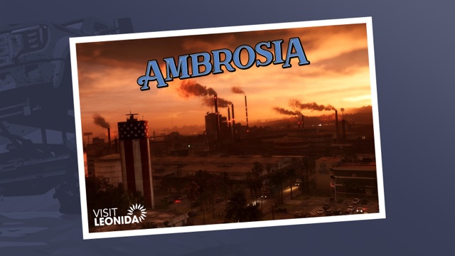
Ambrosia
Leonida's industrial heartland, built around the Allied Crystal sugar refinery, where a local biker gang runs things.
Region
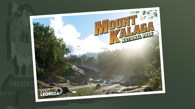
Mount Kalaga National Park
A national park on Leonida's northern border with hunting, fishing and off-road trails, and some colorful locals in the backwoods.
Area
Ocean Beach
A Vice City area that Rockstar highlights for its art deco hotels. The Shore Court garage in the GTA 6 pre-order bonus is near it.
Area
Little Cuba
A Vice City area that Rockstar's official Vice City page mentions for its panaderias, or bakeries.
Landmark
Tisha-Wocka flea market
A flea market in Vice City, one of the places Rockstar names on its official Vice City page.
Landmark
VC Port
A port in Vice City that Rockstar names on its official Vice City page and prints as Port Vice City on its official map, without describing it.

Area
Southside Vice City
An area of Vice City where the GTA 6 Ultimate Edition lets you raid the PTT Youngin$ gang compound. Rockstar's official map prints it as Southside.
Landmark
Allied Crystal sugar refinery
The sugar refinery that Rockstar says Ambrosia, Leonida's industrial heartland, is built around.
Landmark
Leonida Penitentiary
The prison where Lucia Caminos ended up for fighting for her family, according to her official Rockstar profile, until luck got her out.
Area
Washington Beach
The place where the Shitzu Squalo, a boat in the GTA 6 Ultimate Edition, is docked.
Area
Gambit Bay
A bay Rockstar names as a fishing spot in its description of the Shitzu Squalo, a boat in the GTA 6 Ultimate Edition.
Area
Watson Bay
Home of Paradise Garage, where the GTA 6 Ultimate Edition's '67 Vapid Dominator Buggy is stored.

Area
Stockyard
Home of two GTA 6 Ultimate Edition shops: the Electric Fang Tattoo Parlor and the Stock 305 Clothing Store.
Area
Lake Leonida
Home of One-Eyed Willie's Mod Shop, an off-road mod shop that comes with the GTA 6 Ultimate Edition.
Area
Shore Drive
A place named in Rockstar's description of the '95 Grotti Cheetah, which calls the Ultimate Edition car an ode to Shore Drive. Rockstar has not described Shore Drive or said where it is.
Area
Bayside
A neighborhood Lucia Caminos names in An Extended Look, Rockstar's Aug. 27 video, according to SVG. Rockstar has not described Bayside or said which region it is in.
Landmark
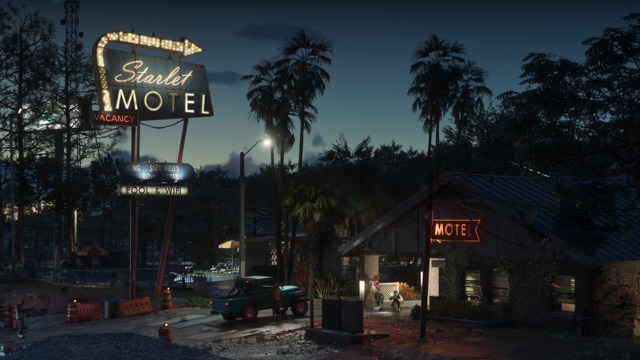
Starlet Motel
A motel in Port Gellhorn with a lit roadside sign for the Starlet Motel, in Rockstar's Port Gellhorn screenshot.
Landmark
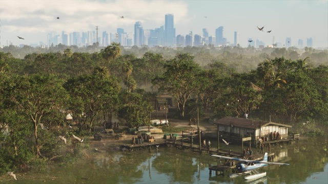
Sunrise RV Park
A riverside RV park in the Grassrivers, its painted Sunrise RV Park sign on a stilt house by the docks in Rockstar's screenshot.

Landmark
Sahara Arena
An arena in Vice City, lit at night, with a sahara arena sign at its base in Rockstar's Vice City screenshot. What it stands in for is unconfirmed.

Landmark
Ocean View Hotel
An art deco hotel in Vice City, its pink neon Ocean View Hotel signs lit up in Rockstar's screenshots of the street at night.
Landmark
Hotel Dixon
A hotel in Vice City whose tall blue Hotel Dixon neon sign stands next to the Ocean View Hotel in Rockstar's screenshot of the street at night.
Landmark
Hotel Valetta
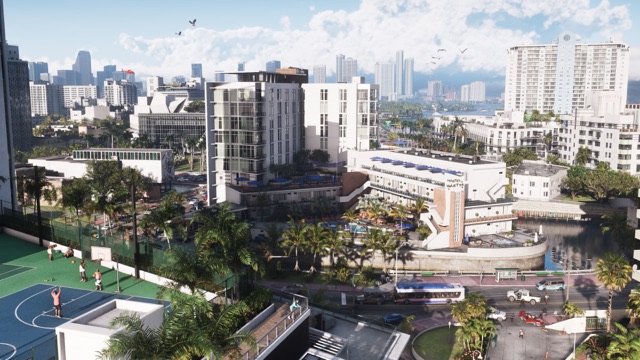
A white hotel in Vice City with a Hotel Valetta sign on its tower, in Rockstar's Vice City screenshot.
Landmark
Ambrosia County Sheriff's Office
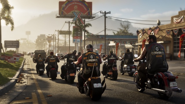
A road sign in Ambrosia points to the Ambrosia County Sheriff's Office, in Rockstar's Ambrosia screenshot.
County
Kelly County
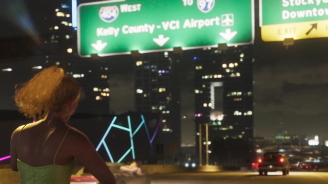
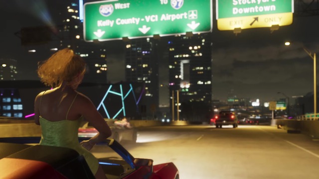
Kelly County is on Interstate 404 signs in Trailer 1, where the westbound lanes head to Kelly County and VCI Airport.
County
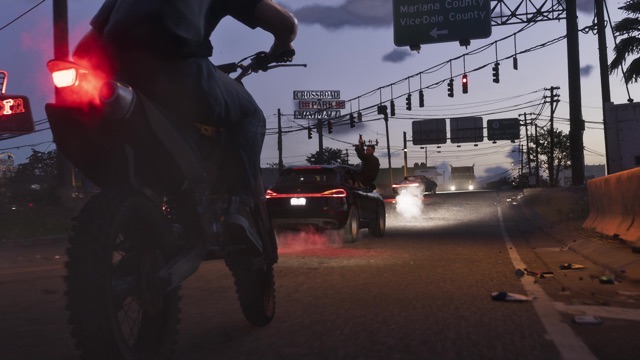
Mariana County
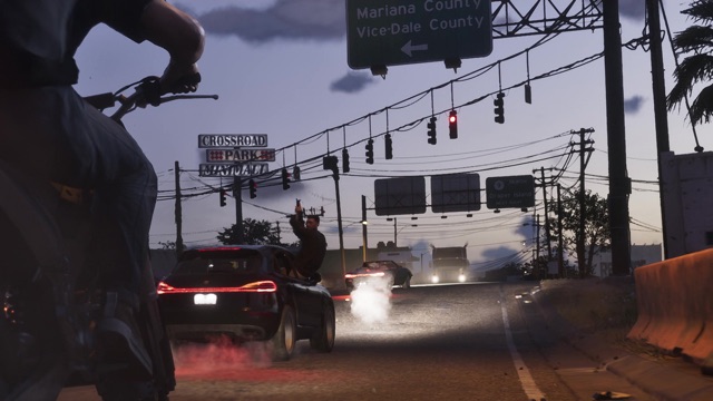
Mariana County is on an Interstate 404 sign in Trailer 2, listed with Vice-Dale County.
County
Vice-Dale County
Vice-Dale County is on an Interstate 404 sign in Trailer 2, and "Vice-Dale" marks a sheriff's badge and a police helicopter in the trailers.
Landmark
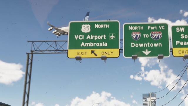
VCI Airport
VCI Airport is on freeway signs in Trailers 1 and 2. Rockstar's official map labels it VCIA and spells it out as Vice City International Airport.
Road
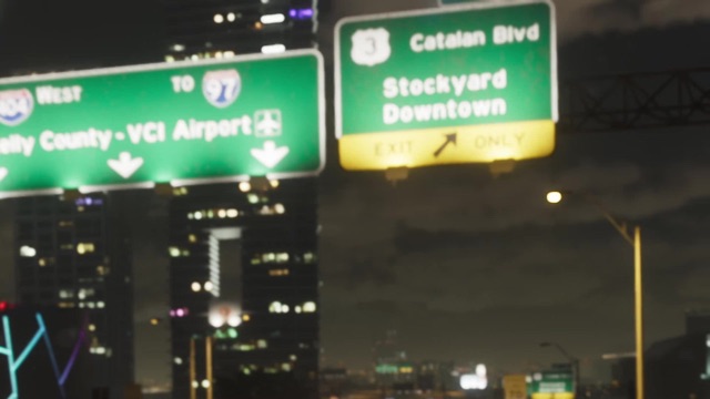
Catalan Boulevard
Catalan Blvd is on a freeway sign in Trailer 1, beside a U.S. 3 shield, with exits for Stockyard and Downtown.
Area
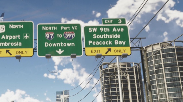
Peacock Bay
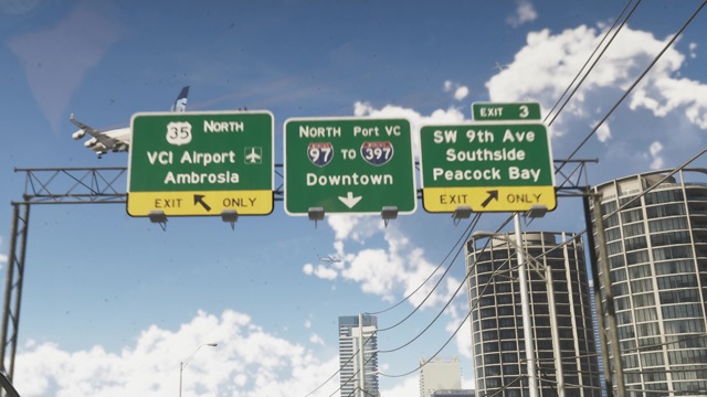
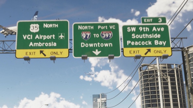
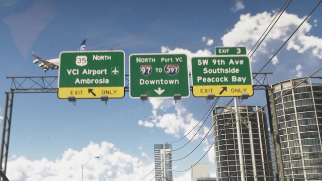
Peacock Bay is on the Exit 3 sign in Trailer 2, together with SW 9th Ave and Southside.
Road
SW 9th Avenue
SW 9th Ave is the first name on the Exit 3 sign in Trailer 2, above Southside and Peacock Bay.
Area
Vice Beach
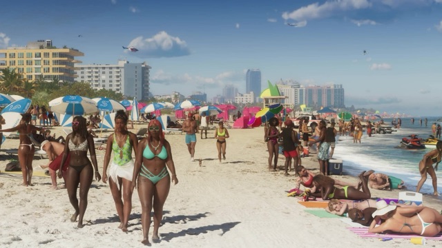
Vice Beach is printed on umbrellas along a crowded beach in Trailer 1, and Interstate 404 signs point to "Vice Beaches".
Area
Hamlet
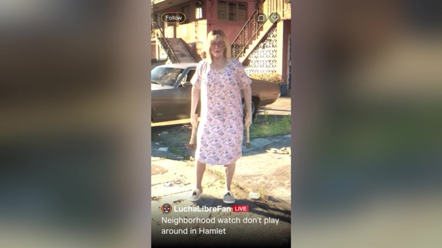
Hamlet is named in a social post in Trailer 1, under a live video about the neighborhood watch.
Area
Waning Sands
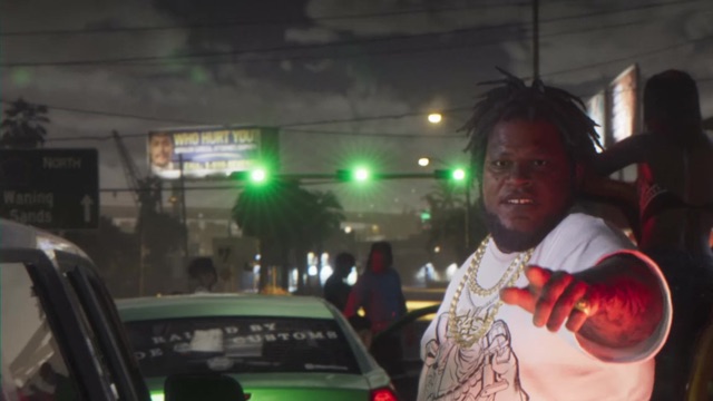
Waning Sands is on a road sign pointing north in Trailer 1.
Landmark
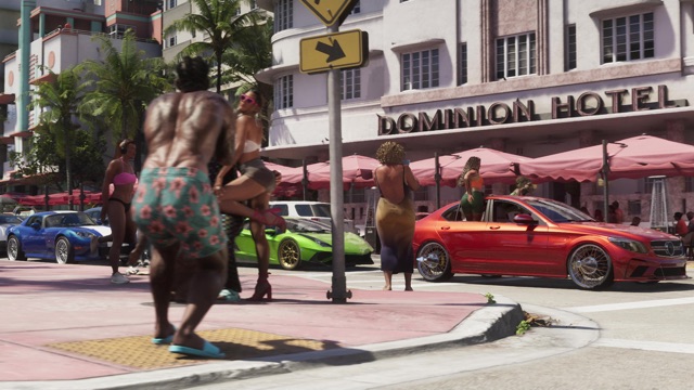
Dominion Hotel
The Dominion Hotel, an Art Deco hotel with umbrellas over its sidewalk tables, stands on a busy beach street in Trailer 2.
Road
Interstate 404
Interstate 404 signs appear in both trailers, for Kelly County, VCI Airport, Vice Beaches, Port VC, Mariana County and Vice-Dale County.
Road
Interstate 97
Interstate 97 is on freeway signs in Trailers 1 and 2, with northbound lanes to Port VC and Downtown.
Road
Interstate 397
Interstate 397 is on a sign in Trailer 2, next to Interstate 97, for northbound traffic to Port VC and Downtown.
Area
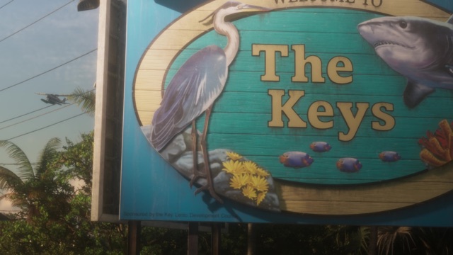
Key Lento
Key Lento is named on the "Welcome to The Keys" sign in the Launch Trailer, which credits the Key Lento Development Council.
Area
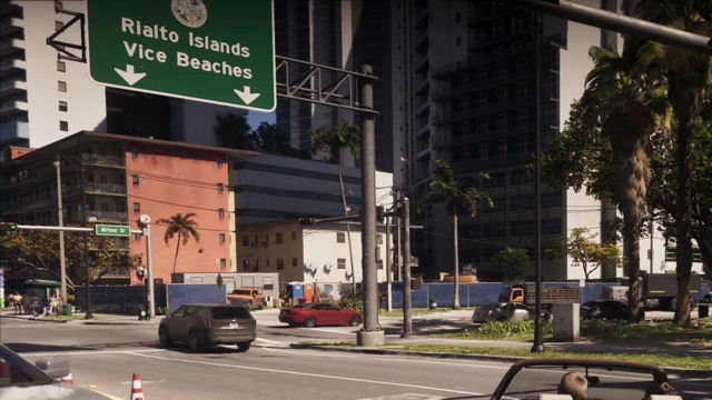
Rialto Islands
Rialto Islands is on freeway signs in An Extended Look, signed together with Vice Beaches.
Area
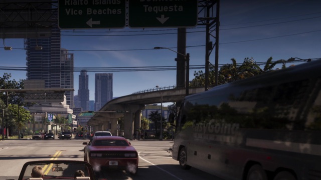
Tequesta
Tequesta is on a freeway sign in An Extended Look, under Downtown, for traffic heading south.
Area
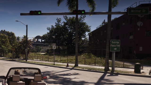
Rockridge
Rockridge is on a street sign in An Extended Look, pointing right toward Rockridge and Fleeca Field.
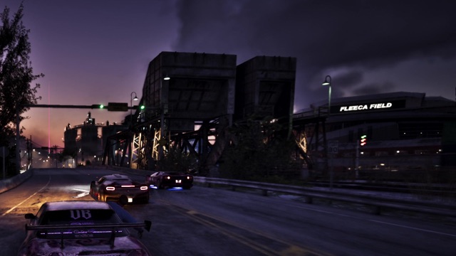
Landmark
Fleeca Field
Fleeca Field, on Rockstar's map just northwest of Rockridge, is a large building whose name is lit up in An Extended Look. Rockstar hasn't said what it is.
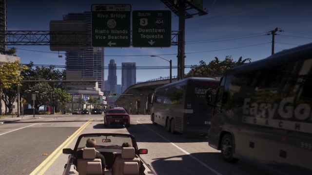
Landmark
Rivo Bridge
Rivo Bridge is on a toll sign in An Extended Look, leading to Rialto Islands and Vice Beaches.
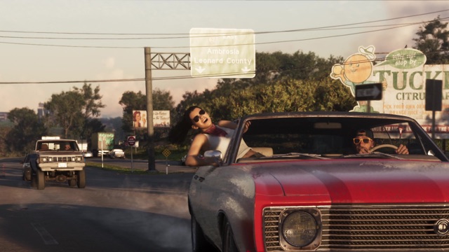
County
Leonard County
Leonard County is on an overhead sign in An Extended Look, listed with Ambrosia.
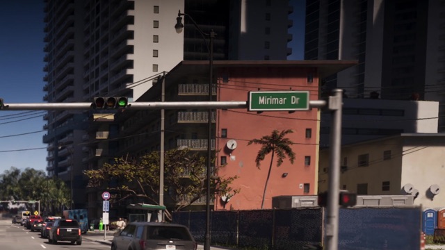
Road
Mirimar Drive
Mirimar Dr is a street sign on a Vice City corner in An Extended Look.
Road
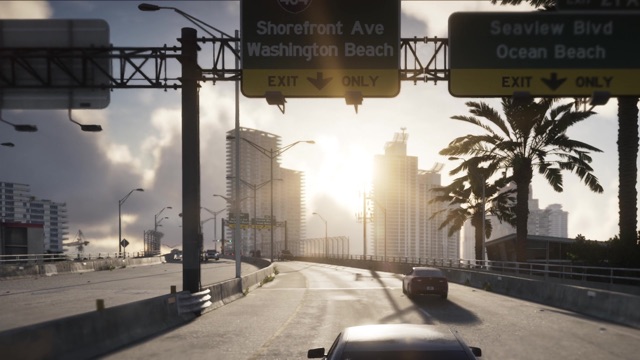
Shorefront Avenue
Shorefront Ave is an exit on Interstate 404 in An Extended Look, signed with Washington Beach.
Road
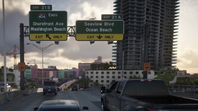
Seaview Boulevard
Seaview Blvd is Exit 21A in An Extended Look, signed with Ocean Beach.
Road
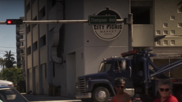
Thompson Avenue
Thompson Ave is a street sign in An Extended Look, on the corner with City Picnic Market.
Road
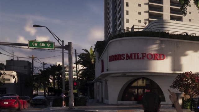
SW 4th Street
SW 4th St is a street sign in An Extended Look, on the corner with Hobbs Milford.
Area
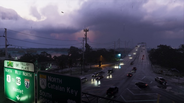
Catalan Key
A key named on a green highway sign in the rainy Key Lento screenshot Rockstar gave The Weather Channel: Toll 1A north to Catalan Key.
Area
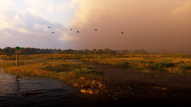
Pelican Valley
A swampy part of Leonida that Rockstar's official map prints between Hamlet and Cottonmouth Lake, first named in The Weather Channel's forecast for the state.
Landmark
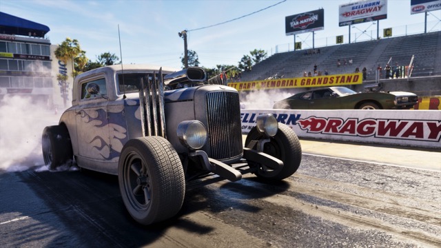
Gellhorn Dragway
A drag strip whose billboard reads Welcome to Gellhorn Dragway, in one of Rockstar's screenshots published with the reviews.

Road
U.S. 35
U.S. 35 North signs point to Ambrosia and the airport, in Trailer 2 and in a Rockstar screenshot published with the reviews.
County
Lummox County
Lummox County is one of five counties on Rockstar's official map of Leonida, printed across the north of the state, above Mount Kalaga National Park.
Area
Bonanza
Bonanza is a place on the north coast of Leonida, named on Rockstar's official map beside Okchiloha Bay, north of the MacAlister Gold Mine.
Area
Grayson
Grayson is a place on the northwest coast of Leonida, named on Rockstar's official map by San Malo Bay, beside a U.S. 628 shield.
Area
Millport
Millport is a place on the northeast coast of Leonida, named on Rockstar's official map west of Millport Basin and southeast of Lake Tallaloko.
Area
Draper Island
Draper Island is an island off Leonida's west coast on Rockstar's official map, north of Draper Bay and northwest of Port Gellhorn.
Area
Belville
Belville is a place named on Rockstar's official map of Leonida, southeast of Ambrosia and Lake Leonida, with Chateau Cellerica to its northwest.
Area
Capri
Capri is a place on Leonida's west coast, named on Rockstar's official map by Capri Sound, beside Tortoise Lake and a U.S. 183 shield.
Area
Southwind
Southwind is a place near the southwest end of the keys on Rockstar's official map of Leonida, beside Mile Zero Air Station, with the Permit Keys to its east.
Area
Moreau
Moreau is a place in the north of Leonida, named on Rockstar's official map between the MacAlister Gold Mine and U.S. 628, south of the Saint Attaway Islands.
Area
East Lummox County
East Lummox County is printed on Rockstar's official map of Leonida in the northeast, between the Frampton Islands and Lake Tallaloko.
Area
South West Lummox County
South West Lummox County is printed on Rockstar's official map of Leonida in the northwest, just below Grayson, west of Mount Kalaga National Park.
Area
North Leonard County
North Leonard County is printed on Rockstar's official map of Leonida north of Lake Leonida, beside an Interstate 297 shield, southwest of Millport.
Area
South Leonard County
South Leonard County is printed on Rockstar's official map of Leonida southwest of Belville, with a County Route 62 shield to its northwest.
Area
North Kelly County
North Kelly County is printed on Rockstar's official map of Leonida south of Interstate 297 and north of the Thrillbilly Mud Club.
Area
South Kelly County
South Kelly County is printed on Rockstar's official map of Leonida south of Leonida State Prison and north of the Nehrling River.
Area
West Vice-Dale County
West Vice-Dale County is printed on Rockstar's official map of Leonida beside Three Toe Lake, west of VCI Airport and south of Interstate 404.
Area
South Vice-Dale
South Vice-Dale is printed on Rockstar's official map of Leonida east of Hamlet, just south of Southside, below a U.S. 35 shield.
Area
Manifest Canyon
Manifest Canyon is printed on Rockstar's official map of Leonida in the northwest, beside Father Scrumpy's Red Apple Orchard, northeast of Port Gellhorn.
Area
Frogswater
Frogswater is printed on Rockstar's official map of Leonida between Port Gellhorn and Ambrosia, southwest of the Thrillbilly Mud Club.
Area
Wild Hog Point
Wild Hog Point is printed on Rockstar's official map of Leonida on the west coast, southwest of Port Gellhorn, beside Wild Hog Airfield.
Area
Gellhorn
Gellhorn is printed on Rockstar's official map of Leonida south of Port Gellhorn, between Gellhorn Raceway and Leonida State Prison.
Area
Emerald Springs
Emerald Springs is printed on Rockstar's official map of Leonida beside the Emerald River, north of Buckskin Swamp and east of U.S. 183.
Area
Buckskin Swamp
Buckskin Swamp is printed on Rockstar's official map of Leonida west of Vice City, north of Interstate 404 and east of Leonida State Prison.
Area
Richard Barebone State Park
Richard Barebone State Park is printed on Rockstar's official map of Leonida on the northeast coast, east of the Mount Hailes Country Club.
Area
Vinewood Beach
Vinewood Beach is printed on Rockstar's official map of Leonida on the east coast, east of Waning Sands, beside the beach on the Atlantic Ocean.
Area
Breakwater Quarry
Breakwater Quarry is printed on Rockstar's official map of Leonida west of VCI Airport, between the Nehrling River and U.S. 82.
Area
Big Pine
Big Pine is printed on Rockstar's official map of Leonida in the southwest, just south of a U.S. 82 shield and east of Tola Bay.
Area
Bluegrass
Bluegrass is printed on Rockstar's official map of Leonida south of VCI Airport, north of Hamlet and west of Southside.
Area
Leaf Links
Leaf Links is printed on Rockstar's official map of Leonida on a green island in the bay, northeast of Decor District and northwest of Penmarch Isle.
Area
Decor District
Decor District is printed on Rockstar's official map of Leonida just north of Stockyard, on the bay southwest of Leaf Links.
Area
La Perle
La Perle is printed on Rockstar's official map of Leonida west of Bayside and southwest of Stockyard, just north of an Interstate 97 shield.
Area
Crosstown
Crosstown is printed on Rockstar's official map of Leonida beside Interstate 97, east of Rockridge and north of Sahara Arena.
Area
Downtown
Downtown is printed on Rockstar's official map of Leonida just below the big Vice City label, east of Little Cuba and north of Interstate 397.
Area
Balsero
Balsero is printed on Rockstar's official map of Leonida east of the Tisha-Wocka flea market, west of Fleeca Field and Rockridge.
Area
Salton
Salton is printed on Rockstar's official map of Leonida west of Little Cuba and northeast of VCI Airport, with Balsero to its northwest.
Area
Tequesta Retreat
Tequesta Retreat is printed on Rockstar's official map of Leonida east of Tequesta and north of the Vice City Oceanarium.
Area
Featherstone Islands
The Featherstone Islands are islands off Leonida's northwest coast on Rockstar's official map, southwest of Okchiloha Bay and north of Grayson.
Area
Saint Attaway Islands
The Saint Attaway Islands are islands off Leonida's north coast on Rockstar's official map, between Bonanza and Hyde Island.
Area
Hyde Island
Hyde Island is an island at the top of Rockstar's official map of Leonida, northeast of the Saint Attaway Islands and west of Partridge Bay.
Area
Frampton Islands
The Frampton Islands are islands off Leonida's northeast coast on Rockstar's official map, south of Partridge Bay and north of East Lummox County.
Area
Little Hardin Island
Little Hardin Island is an island off Leonida's northeast coast on Rockstar's official map, southeast of Millport Basin.
Area
Zephyr Islands
The Zephyr Islands are islands off Leonida's northwest coast on Rockstar's official map, north of Draper Island.
Area
Sandbars
Sandbars is printed on Rockstar's official map of Leonida on a strip of islands far off the west coast, northwest of the Crude Islands.
Area
Crude Islands
The Crude Islands are islands off Leonida's west coast on Rockstar's official map, southwest of Borrachero Sound.
Area
Belpoint
Belpoint is printed on Rockstar's official map of Leonida on a long island off the west coast, southwest of Capri Sound and west of Capri.
Area
Washington Island
Washington Island is an island on Rockstar's official map of Leonida, just west of Washington Beach and east of Leaf Links.
Area
Penmarch Isle
Penmarch Isle is an island on Rockstar's official map of Leonida, southeast of Leaf Links, between Washington Island and the Rialto Islands.
Area
Oldby Island
Oldby Island is an island on Rockstar's official map of Leonida, south of Washington Island and just north of the Vice Beach label.
Area
Casanova Island
Casanova Island is an island on Rockstar's official map of Leonida, east of the Rialto Islands and northeast of Vespucci Island.
Area
Catalan Island
Catalan Island is an island on Rockstar's official map of Leonida, southeast of Bayside and just west of Vespucci Island.
Area
Vespucci Island
Vespucci Island is an island on Rockstar's official map of Leonida, south of the Rialto Islands, between Catalan Island and Casanova Island.
Area
Starfish Island
Starfish Island is an island on Rockstar's official map of Leonida, in the bay between Vice City and Vice Beach, northeast of Waxman Island.
Area
Waxman Island
Waxman Island is an island on Rockstar's official map of Leonida, east of Downtown and southwest of Starfish Island.
Area
Dalton Island
Dalton Island is an island off Leonida's southeast coast on Rockstar's official map, across Catalan Bay from Port Vice City.
Area
Gloriana Key
Gloriana Key is a key on Rockstar's official map of Leonida, east of the Vice City Oceanarium and southwest of Catalan Bay.
Area
Bobcat Key
Bobcat Key is a key off Leonida's southwest coast on Rockstar's official map, southwest of Tola Bay, beside Henry J Edwards Airport.
Area
Corsair Key
Corsair Key is a key on Rockstar's official map of Leonida, on the southeast coast east of Peregrine Bay, along State Route 1A.
Area
Shoeless Keys
The Shoeless Keys are keys on Rockstar's official map of Leonida, north of Key Lento, between Gambit Bay and Peregrine Bay.
Area
Permit Keys
The Permit Keys are keys on Rockstar's official map of Leonida, east of Southwind and west of Maroon Key.
Area
Riquezas Keys
The Riquezas Keys are keys at the far southwest of Rockstar's official map of Leonida, west of Goose Key and Mile Zero Air Station.
Area
Goose Key
Goose Key is a key at the southwest end of Rockstar's official map of Leonida, printed just above Mile Zero Air Station, west of Southwind.
Area
Maroon Key
Maroon Key is a key on Rockstar's official map of Leonida, just north of State Route 1A between Southwind and Key Lento.
Area
Abismo Key
Abismo Key is a key on Rockstar's official map of Leonida, south of Maroon Key, on State Route 1A between Southwind and Key Lento.
Landmark
MacAlister Gold Mine
MacAlister Gold Mine is marked on Rockstar's official map of Leonida in the north, just south of Bonanza and west of Moreau.
Landmark
Tallaloko Lakeside Resort
Tallaloko Lakeside Resort is marked on Rockstar's official map of Leonida in the northeast, by Lake Tallaloko and East Lummox County.
Landmark
Father Scrumpy's Red Apple Orchard
Father Scrumpy's Red Apple Orchard is marked on Rockstar's official map of Leonida in the northwest, beside Manifest Canyon, northeast of Port Gellhorn.
Landmark
Mount Hailes Country Club
Mount Hailes Country Club is marked on Rockstar's official map of Leonida south of Millport, west of Richard Barebone State Park.
Landmark
Ambrosia Raceway Park
Ambrosia Raceway Park is marked on Rockstar's official map of Leonida north of Ambrosia, between the Thrillbilly Mud Club and Lake Leonida.
Landmark
Ambrosia Rodeo Association
Ambrosia Rodeo Association is marked on Rockstar's official map of Leonida just northwest of Ambrosia, south of Ambrosia Raceway Park.
Landmark
Sabal Palms
Sabal Palms is marked on Rockstar's official map of Leonida just west of Waning Sands, northwest of the Evergreen Mall of Waning Sands.
Landmark
Evergreen Mall of Waning Sands
Evergreen Mall of Waning Sands is marked on Rockstar's official map of Leonida just southwest of Waning Sands, above the Leonard County label.
Landmark
Wild Hog Airfield
Wild Hog Airfield is marked on Rockstar's official map of Leonida on the west coast, southwest of Port Gellhorn, just above Wild Hog Point.
Landmark
Howe Dairy
Howe Dairy is marked on Rockstar's official map of Leonida between Port Gellhorn and Ambrosia, south of Frogswater and west of Tucker's Citrus Farms.
Landmark
Tucker's Citrus Farms
Tucker's Citrus Farms is marked on Rockstar's official map of Leonida southwest of Ambrosia, east of Howe Dairy.
Landmark
Chateau Cellerica
Chateau Cellerica is marked on Rockstar's official map of Leonida northwest of Belville and southeast of Ambrosia.
Landmark
Cellerica
Cellerica is marked on Rockstar's official map of Leonida just south of the Belville label, apart from Chateau Cellerica to the northwest.
Landmark
Gellhorn Raceway
Gellhorn Raceway is marked on Rockstar's official map of Leonida on the west coast, south of Port Gellhorn and west of Gellhorn.
Landmark
Leonida State Prison
Leonida State Prison is marked on Rockstar's official map of Leonida east of Gellhorn, beside a U.S. 183 shield, west of the Emerald River.
Landmark
FLAM
FLAM is marked on Rockstar's official map of Leonida on the waterfront south of Crosstown, just north of Sahara Arena.
Landmark
Salton Memorial Island
Salton Memorial Island is a small island on Rockstar's official map of Leonida, in the bay south of Vespucci Island and north of Starfish Island.
Landmark
Sahara Network Data Center
Sahara Network Data Center is marked on Rockstar's official map of Leonida southeast of Breakwater Quarry, east of Big Pine.
Landmark
Henry J Edwards Airport
Henry J Edwards Airport is marked on Rockstar's official map of Leonida on the southwest coast, southeast of Bobcat Key and Tola Bay.
Landmark
Hamlet Correctional Institution
Hamlet Correctional Institution is marked on Rockstar's official map of Leonida just above the big Hamlet label, north of Boone Speedway.
Landmark
Paradise RV Park
Paradise RV Park is marked on Rockstar's official map of Leonida southeast of Grassrivers, just north of the Pelican River.
Landmark
Boone Speedway
Boone Speedway is marked on Rockstar's official map of Leonida just below the big Hamlet label, northeast of Gullet Marsh.
Landmark
Peacock Estates
Peacock Estates is marked on Rockstar's official map of Leonida just south of Peacock Bay and east of Southside.
Landmark
T.H. Power Station
T.H. Power Station is marked on Rockstar's official map of Leonida on the southeast coast, south of South Vice-Dale and north of Peregrine Bay.
Landmark
Vice City Oceanarium
Vice City Oceanarium is marked on Rockstar's official map of Leonida south of Tequesta Retreat and northeast of Courtland Park.
Landmark
Courtland Park
Courtland Park is marked on Rockstar's official map of Leonida just northwest of Catalan Key, southwest of the Vice City Oceanarium.
Landmark
Mile Zero Air Station
Mile Zero Air Station is marked on Rockstar's official map of Leonida at the southwest end of the keys, below Goose Key and southwest of Southwind.
Road
Interstate 297
Interstate 297 is marked on Rockstar's official map of Leonida with two shields across the north, south of Mount Kalaga National Park.
Road
U.S. 628
U.S. 628 is marked on Rockstar's official map of Leonida with two shields across the north, one beside Grayson and one east of Moreau.
Road
U.S. 183
U.S. 183 is marked on Rockstar's official map of Leonida with two shields in the west, one by Capri and one by Leonida State Prison.
Road
U.S. 82
U.S. 82 is marked on Rockstar's official map of Leonida with a shield in the southwest, between Breakwater Quarry and Big Pine.
Road
State Route 1A
State Route 1A is marked on Rockstar's official map of Leonida down the keys, with a dolphin on its shield and a toll shield north of Key Lento.
Road
County Route 62
County Route 62 is marked on Rockstar's official map of Leonida with two shields reading Dale County, southeast of Port Gellhorn and west of Belville.
Area
Okchiloha Bay
Okchiloha Bay is a bay off Leonida's north coast on Rockstar's official map, west of Bonanza and northeast of the Featherstone Islands.
Area
Partridge Bay
Partridge Bay is a bay at the top of Rockstar's official map of Leonida, east of Hyde Island and north of the Frampton Islands.
Area
Moreau River
The Moreau River is named on Rockstar's official map of Leonida on the north coast, southeast of the Saint Attaway Islands and south of Hyde Island.
Area
San Malo Bay
San Malo Bay is a bay off Leonida's northwest coast on Rockstar's official map, just west of Grayson.
Area
Lake Tallaloko
Lake Tallaloko is a lake in the northeast of Rockstar's official map of Leonida, beside Tallaloko Lakeside Resort and northwest of Millport.
Area
Millport Basin
Millport Basin is a stretch of water off Leonida's northeast coast on Rockstar's official map, east of Millport.
Area
Draper Bay
Draper Bay is a bay off Leonida's west coast on Rockstar's official map, between Draper Island and Port Gellhorn.
Area
Borrachero Sound
Borrachero Sound is a stretch of water off Leonida's west coast on Rockstar's official map, southwest of Wild Hog Point.
Area
Burial Creek
Burial Creek is a creek on Rockstar's official map of Leonida, just south of Gellhorn and west of Leonida State Prison.
Area
Emerald River
The Emerald River is named on Rockstar's official map of Leonida just south of Emerald Springs, east of a U.S. 183 shield.
Area
Capri Sound
Capri Sound is a stretch of water off Leonida's west coast on Rockstar's official map, west of Capri and northeast of Belpoint.
Area
Tortoise Lake
Tortoise Lake is a lake on Rockstar's official map of Leonida, on the east side of Capri beside a U.S. 183 shield.
Area
Nehrling River
The Nehrling River is a river on Rockstar's official map of Leonida, south of South Kelly County and northwest of Breakwater Quarry.
Area
Three Toe Lake
Three Toe Lake is a small lake on Rockstar's official map of Leonida, beside West Vice-Dale County and west of VCI Airport.
Area
Catalan Bay
Catalan Bay is a bay on Rockstar's official map of Leonida, southeast of Port Vice City and northwest of Dalton Island.
Area
Bobcat Bight
Bobcat Bight is a stretch of water off Leonida's southwest coast on Rockstar's official map, northwest of Bobcat Key and south of Capri.
Area
Tola Bay
Tola Bay is a bay on Rockstar's official map of Leonida, between Bobcat Key and Big Pine on the southwest coast.
Area
Gulf of Leonida
The Gulf of Leonida is the sea off the state's west coast on Rockstar's official map, named south of Belpoint and west of Bobcat Key.
Area
Pelican River
The Pelican River is a river on Rockstar's official map of Leonida, east of Watson Bay and just south of Paradise RV Park.
Area
Gullet Marsh
Gullet Marsh is a marsh on Rockstar's official map of Leonida, southwest of Hamlet and northwest of Pelican Valley.
Area
Wetman Bay
Wetman Bay is a small bay on Rockstar's official map of Leonida, southeast of the Mariana County label and west of Cottonmouth Lake.
Area
Cottonmouth Lake
Cottonmouth Lake is a lake on Rockstar's official map of Leonida, south of Pelican Valley and northwest of Gambit Bay.
Area
Leonida Bay
Leonida Bay is a bay on Rockstar's official map of Leonida, southwest of the Mariana County label and north of the Permit Keys.
Area
Peregrine Bay
Peregrine Bay is a bay on Rockstar's official map of Leonida, south of the T.H. Power Station and just west of Corsair Key.
Area
Leonida Straits
The Leonida Straits are the waters south of the keys on Rockstar's official map of Leonida, below Mile Zero Air Station.